Rock That Was Already Ancient When the Cambrian Began
The Canadian Shield is not a mountain range or a river system but a geological province — roughly five million square kilometres of exposed Precambrian bedrock arcing from Labrador and the coast of Hudson Bay west through northern Ontario and Manitoba and into the Northwest Territories, with a lobe dipping south into the United States around Lake Superior. It underlies perhaps half of Canada. Where it is not bare it is thinly skinned: a centimetre or two of humus over granite, gneiss and greenstone that crystallised or metamorphosed between roughly 600 million and four billion years ago. The Acasta Gneiss in the Northwest Territories, dated at about 4.03 billion years and studied by the Geological Survey of Canada, is among the oldest exposed crustal rock on Earth.
The Shield's name carries an image: a buckler or escutcheon curved around the basin of Hudson Bay. Geologists use the word more precisely. A shield is a craton — a block of ancient, stable crust that has not been significantly deformed since the Precambrian — brought to the surface and stripped of younger sedimentary cover. Surrounding platforms of the same ancient basement exist across Canada, but they are buried under Paleozoic and Mesozoic sediments. The Shield is what that basement looks like when you remove the lid.
What you see, standing on it, is rock that has been levelled to near-flatness by successive orogenic cycles so old that the mountains they built have long since eroded to stumps. The topography is subdued — rounded domes, shallow lake basins, the occasional ridge — because the rock has had billions of years to weather down and because the most recent levelling agent, the Laurentide Ice Sheet, was thorough. The ice was, in places, over three kilometres thick. It moved south and southeast over the Shield for the last time between roughly 25,000 and 10,000 years ago, and when it went it left a continent repaved.
What the Ice Did to the Surface
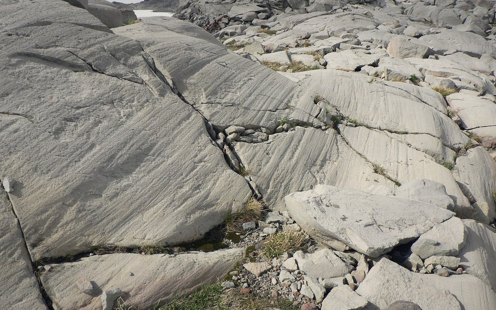
Glaciers are efficient strippers of unconsolidated material and moderately effective abraders of hard rock. The Laurentide ice scraped the Shield almost clean: soils, sediments and any soft lithologies that had accumulated over the preceding interglacials were removed and deposited far to the south as till plains, moraines and outwash fans. What remained was scored bedrock. Striations — parallel scratches ground by rock fragments frozen into the base of the glacier — cover Shield outcrops across the region, recording the direction of ice flow as reliably as fossil compass needles. Where the ice rode over a knob of harder rock, it plucked the downstream side into a steep, ragged face while polishing the upstream slope smooth: the resulting form, called a roche moutonnée, is one of the Shield's most legible landforms.
The ice also depressed the crust. The Laurentide Sheet loaded the Shield with enough mass to push the underlying lithosphere down by hundreds of metres into the viscous mantle below. When the ice melted, that load was removed — but the mantle responds slowly, and the crust is still rising measurably each year across much of the Shield. Around Hudson Bay, rebound rates of one centimetre per year or more have been measured by GPS networks; the bay itself is slowly shallowing as the crust beneath it recovers.
Key measures and ages
Terms- Age of Acasta Gneiss: approximately 4.03 billion yearsamong Earth's oldest exposed crustal rock
- Shield arearoughly five million square kilometres
- Laurentide Ice Sheet thicknessover three kilometres in places, over the Shield
- Ice retreatbroadly 25,000–10,000 years ago (last glacial maximum to deglaciation)
- Sudbury impactapproximately 1.85 billion years ago
- Grenvillian orogenyapproximately one billion years ago
- Hudson Bay isostatic reboundone centimetre per year or more, ongoing
- Canada's lakesestimated one million larger than one hectare, majority on the Shield
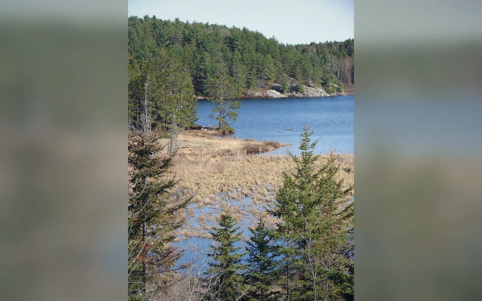
The lakes are the ice's most conspicuous legacy. The Laurentide glacier excavated hollows in weaker zones of the bedrock, overdeepened existing valleys, and deposited moraines and outwash ridges that blocked drainage. When the ice retreated, meltwater had nowhere to go except to pool in these closed basins. The result is a landscape dimpled with standing water: Canada has an estimated one million lakes larger than a hectare, and the great majority of them sit on the Shield. Many are interconnected by short, rapid-strewn rivers that drop across the grain of the rock rather than following it, because the drainage network is still young — geologically speaking — and has not had time to organise itself into an efficient pattern. The Shield is, in this sense, an adolescent landscape: the bones are ancient, but the surface is still settling into itself after the trauma of glaciation.
The Rock Itself, and What It Contains
The Shield is not a single rock type but an assembly of several Precambrian terranes stitched together by ancient collisions. The Superior Province, the largest, is a craton nucleus made mostly of Archean granites and greenstone belts — narrow elongate zones of volcanic and sedimentary rock that preserve evidence of crustal processes operating more than 2.5 billion years ago. The Grenville Province along the Shield's southeastern margin is younger and more intensely deformed, the root zone of a mountain belt that collided with the Superior Province roughly a billion years ago in an event called the Grenvillian orogeny. Each province has its own internal structure, its own suite of rock types, and its own mineral inventory.
That inventory is the reason the Shield's economic history runs as deep as its geology. Nickel and copper at Sudbury, gold along the Abitibi greenstone belt in Ontario and Quebec, uranium at Athabasca, iron ore in Labrador — these deposits formed in Precambrian volcanic and hydrothermal environments and were later exposed by erosion and ice. The Sudbury Basin itself records a meteorite impact roughly 1.85 billion years ago; the shock remelted the crust and concentrated sulphide minerals into the ore body that the Geological Survey of Canada ↗ has documented in detail over more than a century of study. The Shield's ore districts are not accidents but consequences of two billion years of geology preserved almost nowhere else.
Where the Shield meets younger sedimentary basins, the contact is sharp. Southern Ontario and the Prairie provinces sit on Paleozoic carbonates and Mesozoic clastics — flat, fertile, utterly unlike the bare knobbed rock to the north. The boundary is not always a cliff; sometimes it is gradual, with Shield outliers rising through the sedimentary cover, sometimes a clear escarpment. But cross it and the change is immediate: dark outcrops replace ploughed fields, spruce and jack pine replace corn, and the lakes begin.
The Hudson Bay Lowlands, trapped between the Shield and the shores of the bay, preserve a thin drape of marine and glaciolacustrine sediments deposited when the isostatically depressed basin was still occupied by the Tyrrell Sea — the shallow postglacial ocean that covered the region as the ice retreated. Those sediments are soft and young, and beneath them the Shield continues, invisible but uninterrupted. The ancient rock does not end at the lowland margin. It just goes underground again, as it does under the sedimentary platforms to the west and south, waiting for another cycle of erosion — measured in tens of millions of years — to strip its cover and expose it once more.
Rock types named
Terms- Granitecoarse-grained igneous rock; common across Shield terranes
- Gneissmetamorphic rock with banded texture; includes the Acasta Gneiss
- Greenstone beltelongated zone of Archean volcanic and sedimentary rock
- Roche moutonnéeglacially sculpted bedrock knob, smooth upstream, plucked downstream (French: literally "woolly rock," from the resemblance to a sheep's back)