The mark ice leaves
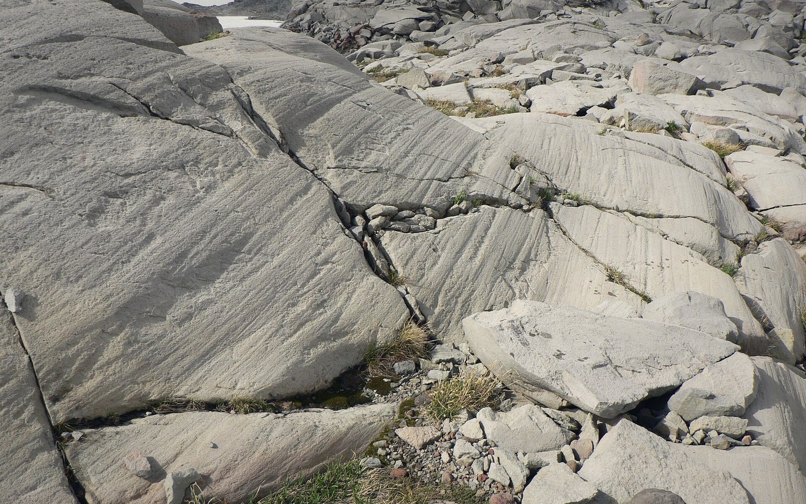
When a glacier moves, it does not slide on clean ice. Its base is armoured — rock fragments plucked from the ground upstream and frozen into the ice, dragged along under the weight of hundreds of metres of glacier above. Those fragments grind against the bedrock beneath, and the result is a striation: a groove cut into hard rock, oriented in the exact direction the ice was travelling when it made it.
On the Canadian Shield, striations survive in extraordinary numbers. The rock is old and hard — Precambrian granite and gneiss, resistant to weathering — and the Canadian Shield was near the centre of the Laurentide Ice Sheet, so almost every exposed surface records the passage of ice. Outcrops across Ontario, Québec and the Northwest Territories carry parallel grooves so consistent in direction that the ice flow pattern across a continent can be reconstructed from them.
The mechanics are straightforward. A clast — a fragment of rock held in the glacier's sole — acts as a cutting tool. Softer rock below is scratched; the clast itself is often scratched too, producing facets that geologists call striated stones or bullet boulders, their tapered end pointing in the upstream direction. The striations left on bedrock range from fine scratches a millimetre wide to deep channels tens of centimetres across, depending on clast size, ice velocity, and how long the tool remained in contact before being shed.
What striations cannot tell you is which end of the groove was the start. Ice travelled in one direction, but the scratch is symmetrical. Geologists resolve this using other features on the same surface: chatter marks (a series of curved cracks on the down-ice side of an obstacle), crescentic gouges, and rat tails (thin ridges in the lee of a hard mineral grain) all preserve asymmetry and confirm the direction of travel. Where multiple sets of striations cross at angles, they record separate glacial advances — sometimes from different directions — separated by thousands of years.
What the features are
Terms- Striationa groove cut into bedrock by a rock fragment frozen into the base of moving ice
- Clasta rock fragment carried in the glacier's sole and acting as the cutting tool
- Bullet bouldera clast striated and shaped by glacial transport, tapered end pointing up-ice
- Chatter markscurved cracks on the down-ice face of a bedrock obstacle, confirming travel direction
- Crescentic gougea crescent-shaped scar in bedrock, asymmetric and direction-indicating
- Rat taila thin bedrock ridge in the lee of a hard mineral grain, pointing down-ice
The Geological Survey of Canada ↗ has mapped striation orientations across the country since the nineteenth century, building a picture of how the Laurentide Ice Sheet's lobes shifted over time. At its maximum, roughly twenty thousand years ago, the ice over Hudson Bay was thick enough to depress the crust by hundreds of metres — the isostatic rebound still measurable today is the land's ongoing response to that load.
Striations are perishable by geological standards. A few thousand years of sub-aerial weathering softens them; a riverbed erases them quickly. The Shield's dry, stable outcrops are among the best preservation environments on Earth, which is why the glacial record there reads so clearly.
Chronology
In order- ~20,000 years agoLaurentide Ice Sheet near maximum extent; ice over Hudson Bay thick enough to depress the crust by hundreds of metres
- 19th century onwardGeological Survey of Canada begins systematic mapping of striation orientations
- Presentisostatic rebound continues as the crust recovers from the ice load